Miscellaneous Road Photos (Page 4)
Page 1 | 2 |
3 | 4
Various 2002 Roadtrip Photos
Rich, Mississippi
Rich is a small community along old U.S. 61 in northern Coahoma
County; like most of the smaller places along U.S. 61, it has
long-since been bypassed by the main highway. Rich is also being
bypassed by an extension of MS 315 to the U.S. 49/61 intersection
northwest of the town (MS 315 currently ends at the Coahoma/Quitman
county line).
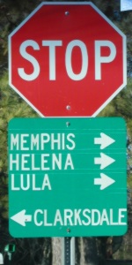 |
Old U.S. 61 lives on, after a fashion, due to this small green
sign that shows the main cities in each direction along the old
highway. This sign is located at the end of Birdie Rd, which
becomes MS 315 at the county line. |
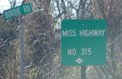 |
This sign is at the same intersection as the sign above,
directing traffic from old U.S. 61 to MS 315. |
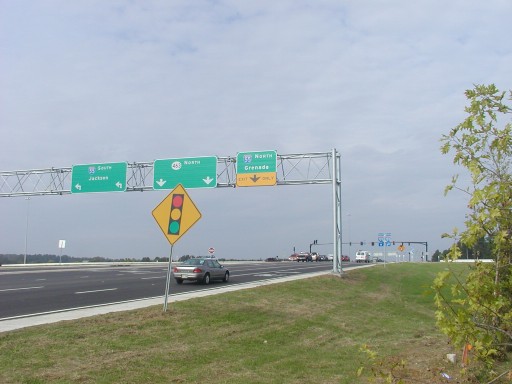
Jackson Airport Roundabout
MDOT likes to build its "experiments" close to Jackson; the
state's first SPUI is just north of the city, and its first
roundabout is on MS 475 at the airport.
 |
This is the standard signage used for modern roundabouts in the
U.S. Some people think a sign similar to that used in Europe (which
emphasizes the direction of traffic flow around the circle with
arrows) would be better. (This sign is on northbound MS 475.) |
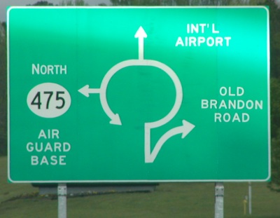 |
This sign shows the various exits from the roundabout. Note
that U.S. roundabouts generally have a special lane for the first
right turn from the circle, while European roundabouts usually do
not. The traffic rules are like those used in Britain; traffic
entering yields to traffic already in the circle, rather than using
the traditional French rule of priorité à
droite.
The long-term plan is for this traffic circle to be bypassed by
the mainline MS 475, along with a more direct freeway to be built
from downtown Jackson to the airport itself.
|
Walker CR 22: Cordova, Alabama
The photos that used to be here can now be found here.
Metropolis, Illinois and Mayfield, Kentucky
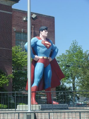 |
The promised "Superman statue" in downtown Metropolis; I only
found out about it from the small sign at the exit from the
Illinois Welcome Center on I-24. It's poorly signed overall. For
the record: take US 45 north into Metropolis, turn right at the
traffic signal downtown (where the casino is marked to turn left),
and make a left on 6th Street. |
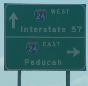 |
I-24 really doesn't go anywhere important in Illinois (in fact,
its mainline control cities are "St. Louis" and "Nashville"). Even
the local control cities are scarce; north of U.S. 45 (the
southernmost exit), the most worthwhile destination is another
interstate highway! |
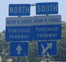 |
The Purchase Parkway was recently renamed to the "Julian M.
Carroll Purchase Parkway"; along with the name change came new
signs. These are on southbound U.S. 45 near Mayfield. |
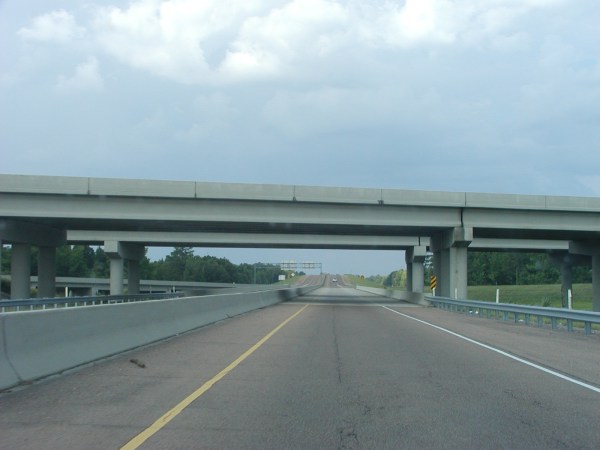
Clarksdale Bypass
 |
| The U.S. 49 Clarksdale Bypass (eventually to also carry U.S. 61
and I-69 signage) is a standard, boring Mississippi freeway with
gravel shoulders. |
 |
| Current end of the Clarksdale Bypass; west of here, the grading
and bridging is done for the remaining section, with paving due to
be completed in the next couple of years. |
Alt U.S. 45 and MS 8 interchange signage
 |
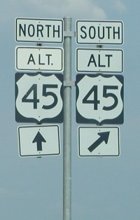
| Signage at the interchange a few miles west of Aberdeen. |
|
| Note the non-reflective "Alt." panel (including non-standard
period) on the left-hand sign. |
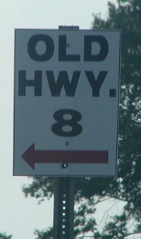 |
| Locally-installed signage for Old Highway 8 from MS 8. (The
arrow is red, if you can't tell.) |
Aberdeen Pseudo-Bypass Signage
The newly-opened U.S. 45 Aberdeen bypass bypasses much of
Aberdeen, but has a 35 mph section with no control of access
through the southern portion of the town along the MS 25
multiplex.
 |
 |
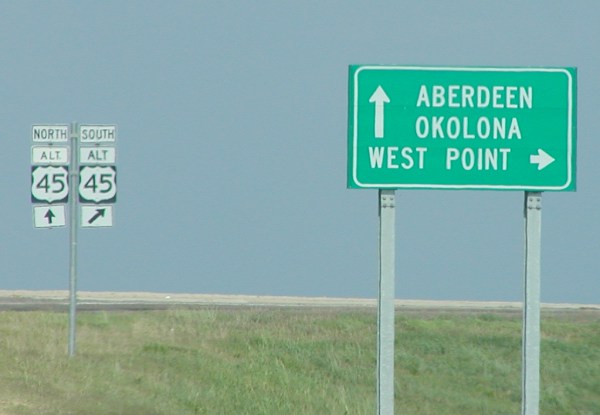
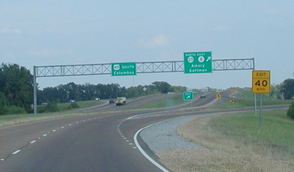
| Signage from the MS 8 interchange. Even though MS 8
multiplexes with U.S. 45, the multiplex is ignored by the large
South sign. |
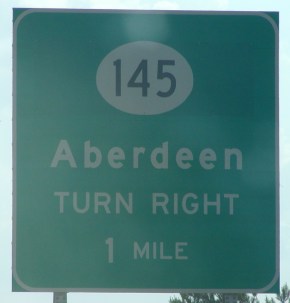 |
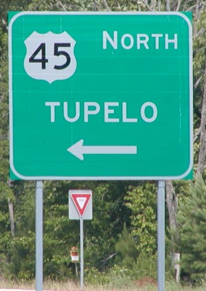
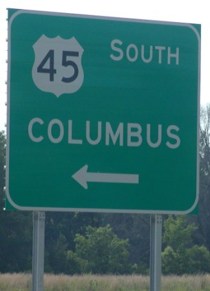
BGS on northbound U.S. 45 for the MS 145 (Old U.S. 45)
turnoff. |
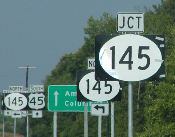 |
| Absolutely horridly out-of-proportion signage for MS 145.
Quality use of freeway-size shields with surface-street tabs, and
note the lovely masking tape still affixed to the sign. Further
back, note the mismatched North and South tabs. |
 |
 |
| Views of the trumpet interchange between U.S. 45 and MS 25/MS 8
southeast of Aberdeen. The short MS 25 expressway continues about a
mile to the east, to just past where MS 25 and MS 8 split. |
 |
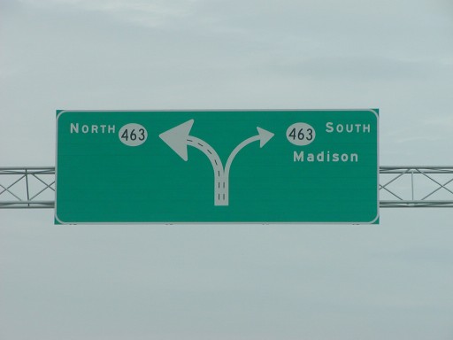 |
| Signage at the MS 463/I-55 interchange, Mississippi's first
SPUI. |
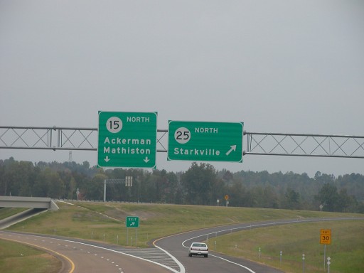 |
| Signage at the northern split of MS 15 and 25 near
Louisville. |
Page 1 | 2 |
3 | 4
Back to my roads pages.
Chris
Lawrence <chris@lordsutch.com>
(28 Apr 2003 at 05:00 CDT)