Ontario Hwy 400/69 Photos
Highway 400 is the main route between Toronto and points north in
the province. Just past Barrie, Highway 11 branchs off inland toward
North Bay while Highway 400 continues closer to Georgian Bay on its way
to Sudbury. The Trans Canada Higway (TCH) Georgian Bay route joins
Hwy 400 at Coldwater.
At present, Highway 400 apparently ends at the end of the
continuous four-lane section at the Go Home River a few kilometers
north of the Muskoka District Road 38/32 intersection, at the end of
the continuous freeway. However, the 100 km/h speed limit is retained
through the intersection. (In addition, south of here are a number of
unnumbered, "right-on, right off" exits from the southbound roadway.)
North of here, the Highway 69 designation takes over, even along the
completed freeway bypass of Parry Sound and (apparently) the future
freeway between the Moon River and the Parry Sound bypass. According
to Chris Bessert's site, the long-term plan is for the Hwy 400
designation to be extended once the gap between the Moon and Go Home
rivers (about 8 kilometers) is upgraded to a freeway.
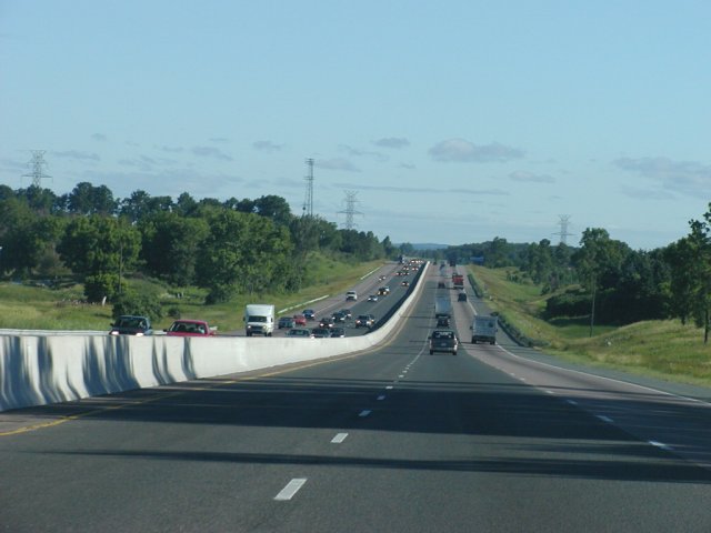 |
| This is a typical 6-lane segment of Hwy 400 between Toronto
and Barrie. Note the lack of a left shoulder. Other sections are
separated by a continuous rail, rather than the newer Jersey
barrier. |
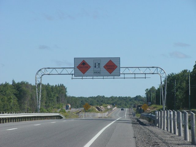 |
| This overhead sign indicates the two-lane highway ahead.
Additional overhead signs have been installed along the two-lane
segment to reinforce the lower speed limit (90 km/h) and two-way
traffic conditions. |
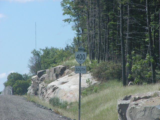 |
| This is the first indication southbound that Hwy 400 has
started, at the beginning of the southbound continuous four-lane.
While at the 400/11 split near Barrie, 400 is marked as "To Hwy 69,"
there is no reciprocal signage along Hwy 69 to indicate that the
number will change. |
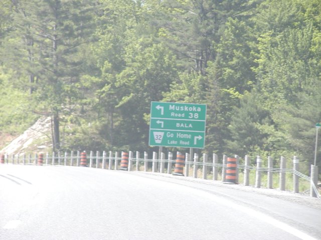 |
| Signage for the sole at-grade intersection on Hwy 400
(southbound). Despite the median break, the speed limit is not
lowered and there is no indication that freeway regulations do not
apply any more. |
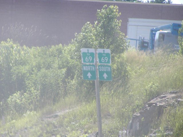 |
| Trailblazers for Hwy 69 in Parry Sound. Note the separate
north and south trailblazers, even though traffic in both directions
now enters at the same interchange. |
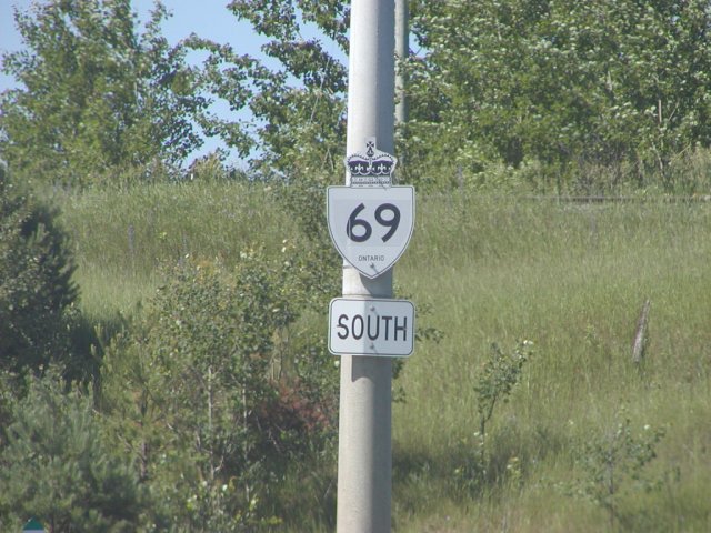 |
| Marker on southbound Hwy 69 at Muskoka Road 169 (former Hwy
169) in Foot's Bay, the southernmost Hwy 69 marker on the current
highway. However, a new "Hwy 69 Toronto" guide sign has been
installed on the road approaching Future Exit 186 of Hwy 69, which is
where the old alignment rejoins the freeway route. |
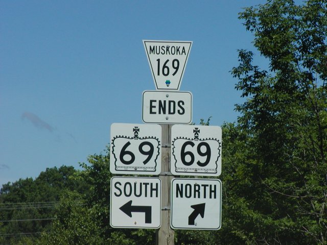 |
| Signage assembly at the Hwy 69/Muskoka Rd 169 intersection.
Note the radically different signs for North and South. |
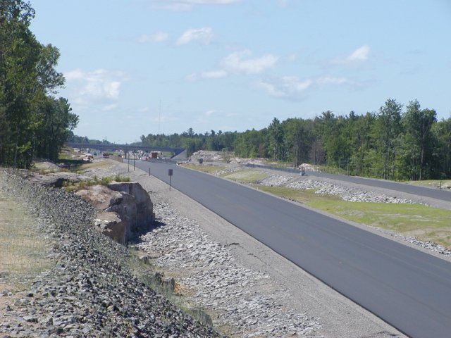 |
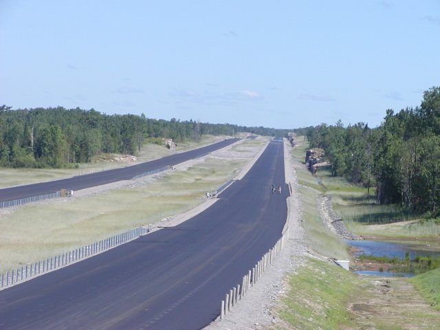 |
| Views of the new Hwy 69 freeway alignment from an overpass
just north of where Hwy 69's new alignment branches from the old
alignment near Foot's Bay. |
Back to my Ontario road photos collection.
Chris Lawrence <chris@lordsutch.com>
(15 Jul 2002 at 20:09 CDT)


